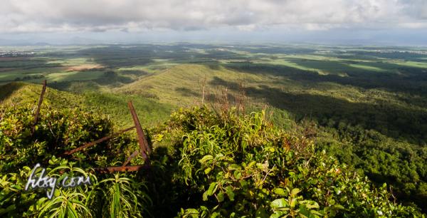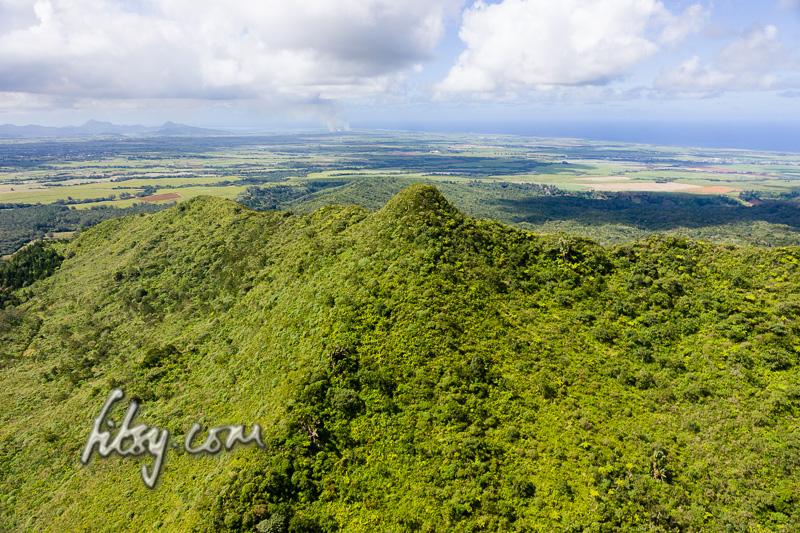
Piton Savanne mountain offers some good views of the south coast of Mauritius, and although the track can be overgrown in places, is a very accessible route with no major obstacles on the way.
Location
Piton Savanne mountain is located in the south of the Island of Mauritius and along with its neighbour Mount Cocotte are the only mountains offering views over the southern tip of the island.
The route starts at a location just off the main road from the round-about at Les Marres towards the southern town of Chemin Grenier. The area is visible from the main road, as there is a clearing next to a large grey gate.
There are no bus routes which serve this area, so a car is the only practical way of reaching this point.
Route Description
The route to Piton Savanne mountain passes through parts of the Black River National Park which is closed off to the general public due to the Mauritian Pink Pigeon breeding program which takes place in the area.
You will need to request permission from the watchman who is stationed behind the gates, and once you are on the track, avoid wandering into the woods as hunting sometimes takes place in the area.
I would recommend you take a long blade knife as the track is overgrown towards the summit of the mountain, and nettles can be a painful nuisance.
- Make your way to the starting point at the cleraing just off the road from Les Marres to Chemin Grenier where you can park your transport.
- After requesting permission from the watchman, follow the track eastwards along the fairly wide untarred road.
- The track passes along a Telecommunication tower, around a corner and then goes slightly downhill.
- At the bottom of this hill, the wide track will continue to the left, but straight ahead of you, you will notice a foot track up in the vegetation. Leave the wide track and continue along the smaller foot path upwards.
- The footpath continues uphill and at the top of this hill, you will have a view of Piton Savanne mountain, and the hills towards the south of the Island.
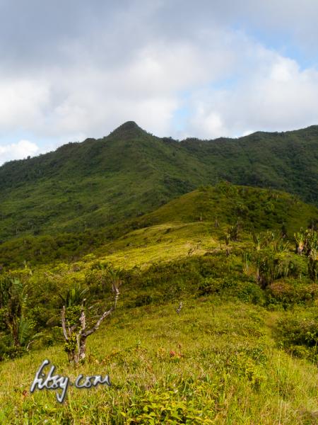
- You will be able to see the track heading downhill and then back up into the mountain from this location.
- Continue along the track, taking care not to get scratched by the overgrown nettles as you approach closer to the summit.
- As you reach the base of the summit, there area a couple of small boulders in the way, and continue around the base of the summit, where on the southern side, the path continues upwards across some boulders and trees.
- Using the trees and branches as support, make your way up to the summit.
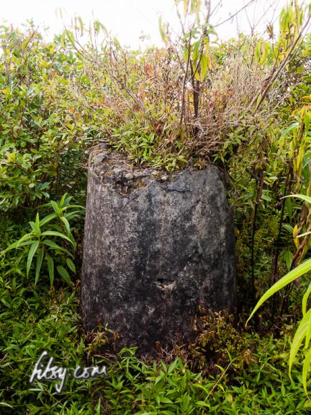
- Once at the top of the summit, you will find the remains of a viewing platform, and a concrete structure which you can climb to get some better views which are obscured by the trees growing on the summit.
From here you can see that there are other tracks leading to and from the summit, and along the mountain ridge to Piton Capotte and Piton Poule at the southern extremity of the Savanne Mountain Range. You may want to explore these routes if you have to time to extend your journey.