
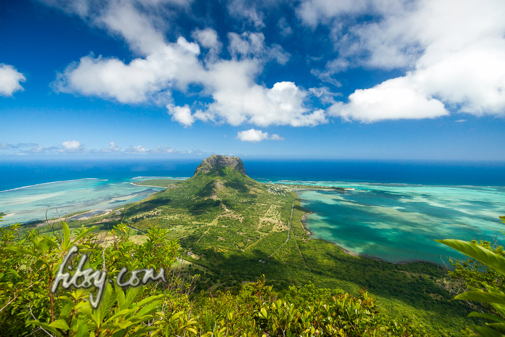
Le Morne mountain has a lot of history...
Finally, in mid 2016, the disputes ended which meant that the hiking track to the mountain was opened up to the public.
The hiking track is managed, with a parking area opposite the entrance, and there is a gate at the start of the track which is open from 07:00 to 16:00.
This hike is popular and it is likely that there will be quite a few hikers undertaking this route. The path is mostly well signposted and clear, so using the GPS track isn't required to find your way to the summit.
There are two parts to the hike, the first part starts from the entrance and follows a well maintained forestry track to reach a plateau with a viewpoint, and from here, the typical mountain climbing path starts to the small summit where the steel cross is located. Strictly speaking, this isn't the uppermost summit of the mountain, as to reach the summit, mountain climbing equipment will be needed to cross a cleft. Nonetheless, this is an interesting hike which should be on your list of 'to-do' mountains.
As of September 2016, the part of the trail from the plateau to the cross is officially closed due to the ropes placed on the rocky ascent being 'under maintenance', but this should not be an impediment to reaching the summit by the cross, as the ropes are not necessary for either the ascent or the descent, and you will find plenty of people ignoring the warnings to continue to the summit. There is also conflicting information about whether hikers are allowed to continue to the cross without the use of guides. It would be wise to inform yourself beforehand in case you are challenged "aggressively".
Note, the mountain trail from the viewpoint to the cross has been helpfully described as: "In the Alps this could be rated as climbing grade between I and II on the international UIAA rock climbing scale."
Location
Le Morne mountain is in the South Western extremity of the island, and the start of the hiking path is off a coastal road which can be accessed from both the northern and southern sides of the peninsula. When arriving near Le Morne peninsula, there are signposts on the road indicating the location to the start of the track, by passing either to the North or South of the mountain.
Description
- Park your transport in the parking area and make your way to the entrance.
- Fill in your details (Name, Nationality, Phone number & time) in the guest book and proceed to the track which will veer west and eventually upwards towards the north east along the mountain slope.
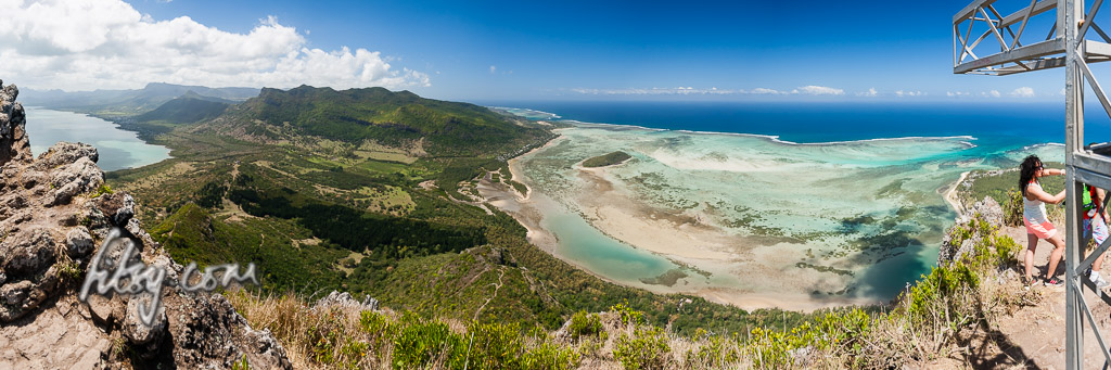
- You will eventually reach the plateau where there are a couple of benches in the shade, a signpost towards a further viewpoint to the North, and the start of the mountain track going backwards, parallel to the track you undertook to reach this point.
- As of September 2016, this part of the track is 'officially' closed, with a fence around the track, but follow the fence to the left for a few meters and pass around the end of the fence to rejoin the track.
- Follow the path for a little further and you will be faced with a rocky gully which you must ascend. During my visit, this is the location where a lot of hikers turned back.
- There is a rope placed here to ease the ascent and descent, but don't place too much emphasis on using the rope, as its condition is unknown and there are plenty of handholds and footholds to make the ascent possible without too much effort.
- When you emerge from the gully, the path heads towards the South West, passing close to the edge of a drop where more, shorter, lengths of rope have been placed and then towards the North to a small clearing just under the summit.
- Look towards the South West again, and you will see small sections of rope to reach the summit by the cross.
- Tackle the rock head on using whatever handholds are suitable and after a short climb, you will have reached the end of the hike where the steel cross is located.
- This pseudo summit is fairly small and can get quite crowded when there are many hikers. But take your time to enjoy the views before making your way down the same way you came.
- Allow around 2 hours for the ascent and around the same time for the descent.