
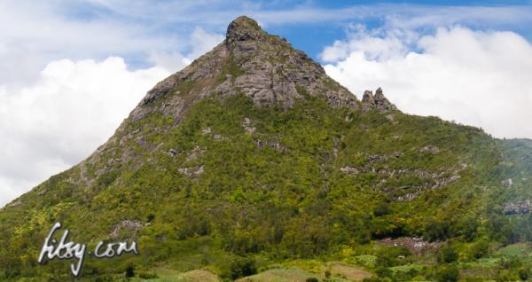
Location
Guiby peak is at the eastern end of the Moka mountain range, near the villages of Petit Verger near Saint Pierre, Moka. The path starts at the same location as the path for Le Pouce mountain.

Description
The initial part consists of reaching the two small peaks on the ridge of the mountain, using a gully which strictly speaking, does not have a path, as you need to make your way through woods, which as you move further up, get thicker and more difficult to pass through due to close growing chinese guava trees.
There is an alternative route to reach the two small peaks, but this route is found on private land used for deer farming, and the watchman will not allow you to use this path.
- Make your way to the start of the path, at the same location used to hike to Le Pouce mountain.
- Follow the GPS path through the cane fields and you will come to a small agricultural area with a corrugated iron shack on your left.
- Pass by the garden and make your way into the woods.
- There isn't a visible path, but the woods are sparse growing in the lower area and follow in the general direction of the gully which will take you to the ridge.
- As you move higher into the gully, keep inside the gully and avoid leaving it to either side, as traces of a path can be impossible to find.
- When you reach near the top of the gully, avoid following the gully to the left, you will need to pass through some very close growing guava trees on the ahead-right to continue up to the opening on the ridge.
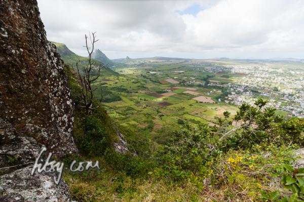
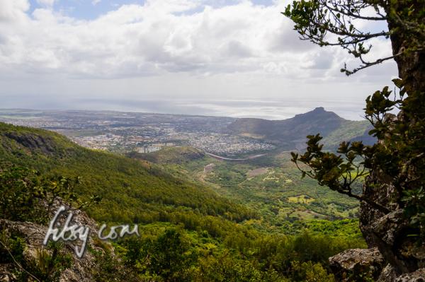
- When you eventually make it to the ridge, you will have views over Saint Pierre to the South, and Pailles to the North.
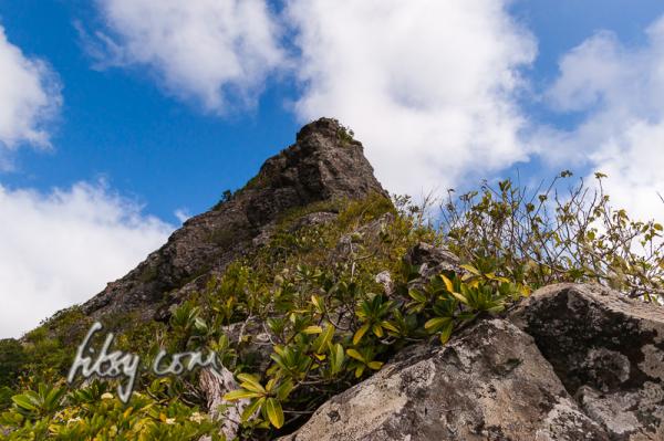
- From this point onwards, things get a little more exciting. The ridge becomes narrower, steep and you have to make your way using the small shrubs as handholds. The strong winds also do not help.
- You will then reach a large slab of rock which must be overcome to continue to the summit. This is where the GPS track log ends as we were unable to make it past this point.
It might look easier on a second attempt, but looked quite intimidating on the first attempt. There are rumours that there could be an alternative way up to the summit starting from the Moka side, but this is subject to future exploration.