

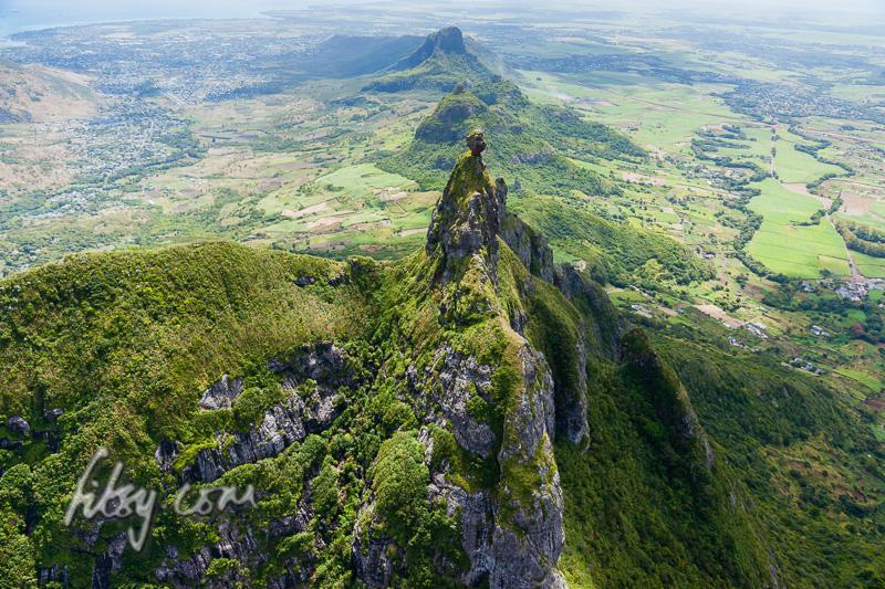
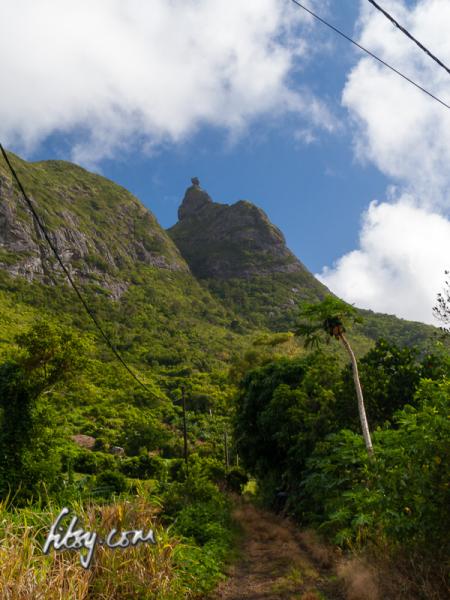
The mountain of Pieter Both has an interesting shape, with a large boulder balanced on a slender peak. This mountain is one of the most discerning features of the Mauritian landscape.
The ascent of Pieter Both can be described as being in two stages, the first involves reaching the so called shoulder and for those willing to continue, the second part involves ascending the slender peak and onto the boulder at the top of the mountain. Iron rungs were placed in the rock many years ago, but the condition of these rungs have deteriorated, making the final ascent unsafe without the help of ropes and rock climbing experience.
Location
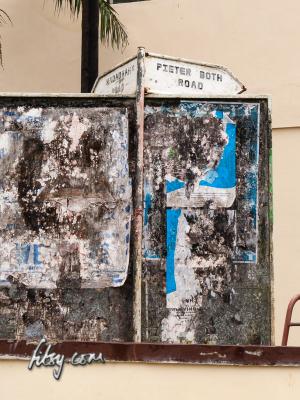
The path to climb Pieter Both mountain starts in the small village of La Laura, near St. Pierre.
La Laura and the neighbouring village of Malenga are served by buses travelling from St. Pierre.
I should note that my attempt at climbing Pieter Both ended prematurely due to deteriorating weather conditions. Nonetheless, the GPS track log will take you to just before the 'shoulder' part of the mountain.
Description
- Make your way to Pieter Both road at La Laura village. At the junction of Pieter Both road, continue straight towards the mountain.
The road will eventually become untarred, and find a convenient spot to park your transport if necessary.
- Follow the wide grassy road and it will curve towards the East. It will eventually end facing tall growing chinese guava trees.
- Look to your left, or northwards, and you will see the track heading into the undergrowth.
- The track passes through tall growing guava trees, eventually emerging at a large rock face a few dozen metres later. Climb the rock face head on, or use the trees and shrubs growing at the side for support. The track continues at the top left of the rock face.
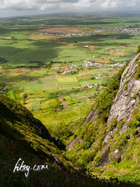
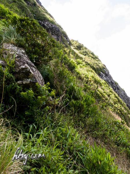
- The path here is generally clear and easy to follow, but as you continue the route and reach the small valley between Pieter Both and Creve Coeur mountains, the track can become overgrown in places and the ground is not very clear. Take care when you place your feet on the ground.
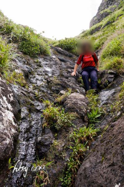
- You will eventually reach your first hurdle which is the first part of a wet v-gully. If you are feeling confident, head straight up, or for those a little more cautious, use the rocks which are conveniently placed between the rock faces to place your feet as you make your way up.
- The track continues along a grassy slope where you should be careful. Remember the way you took as it isn't easy to see the exact path on your way down.
- You will next face another part of the wet v-gully, this will require some care as there is nothing to hold on while climbing it. Note that the GPS log ends a few metres past this point.
- The path will continue on the grassy slope and will then turn rightwards across a narrow edge on the mountain, which will lead you to the 'shoulder' part of Pieter Both mountain.
On your way back home, you may want to visit the Northern Viewpoint in the village of Malenga. Take a left (eastwards) at the junction when you come to the end of Pieter Both road