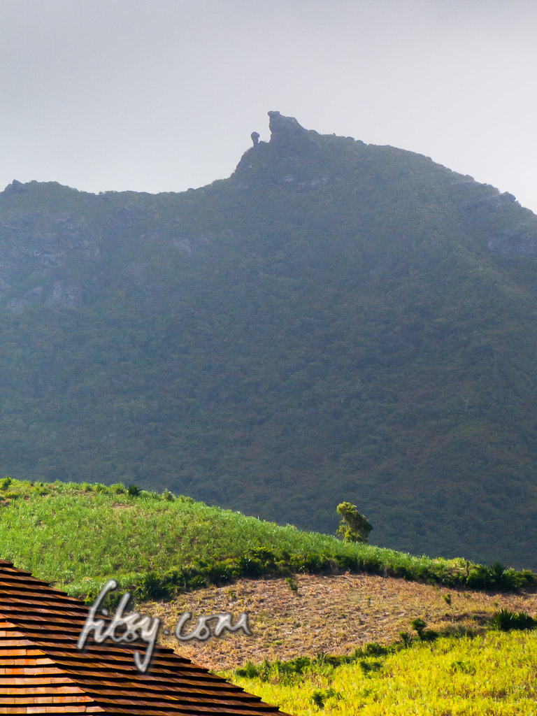
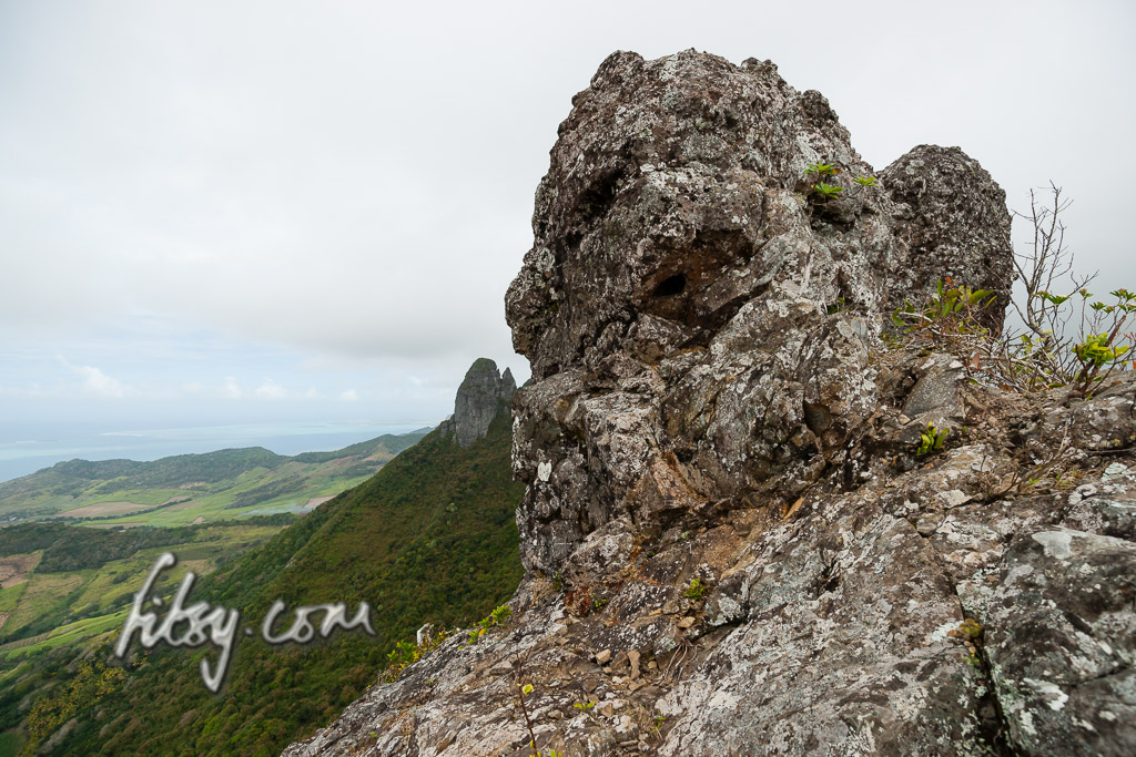
The name of the mountain, Le Chat et la Souris, translates to 'The cat and the mouse', due to the appearance of the rocky summit when viewed from the south, resembling a cat looking down onto a small mouse.
This mountain is not particularly high, with views very similar to its taller neighbour Bambous mountain, but is less streneous to reach the summit though the round trip route described here is a little lengthy. This is an overall enjoyable hike with no technical difficulties, though those wishing to climb to the top of the cat's head might find the space available a little small.
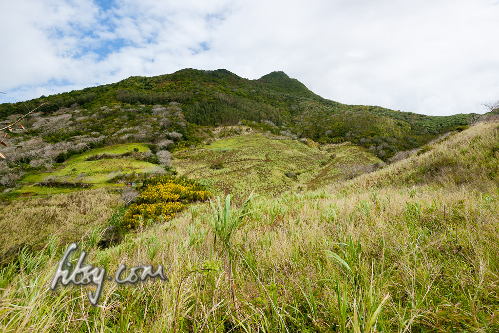
The route described here starts inland from the coastal village of Quatre Soeurs, joins the path on the ridge to the summit and follows an alternative path down to rejoin the starting location.
Location
The path starts inland from the coastal village of Quatre Soeurs, located on the East coast of Mauritius. If you are travelling to this location from the West of the island, or further afield, then plan adequately as the trip to the starting point could take around an hour or more.
Description
- Make your way to the village of Quatre Soeurs, and follow the residential road at the junction leading inland.
- Towards the end of the road, follow it to the left at the intersection, and immediately cross a bridge over a small stream and park your transport at the small clearing next to the stream.
- Follow the tarred road upwards, which after passing some residential houses will turn into a cane track.
- Turn right into the firebreak on the mountain slope, and look for traces of a path leading upwards into the mountain.
- The path might not be clear, but the forest is relatively sparse growing in this area, making it not too streneous to make headway through it. Your aim is to reach the ridge where the path is clearer.
- Once on the ridge, the path becomes easier to follow, and in some places continues around rocky outcrops and in others, continues over them.
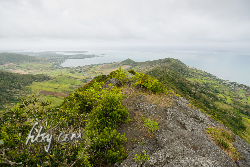
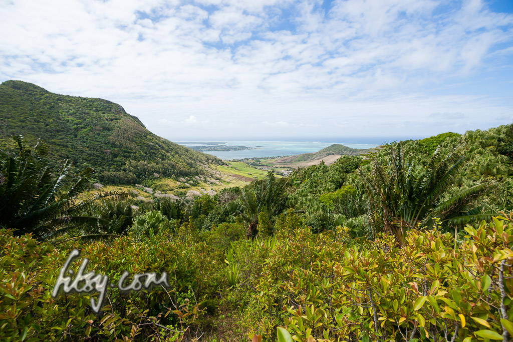
- There are a couple of viewpoints on the ridge giving views over the lagoon to the South East, and inland towards the summit and Bambous Mountain.

- You will eventually reach the base of the summit giving views onto the East coast, and for the more adventurous, you can scale the rock forming the cat to give you better views inland. Note that there is very little space on the summit rock in which to play, so you might find enjoying the views from just under the summit more relaxing.
- Once you decide to make the ascent down, you can either follow the route you just came by, or follow the gps track along an alternative route which will take you back to your transport.
- Follow the gpx track closely from the summit, as the location where to leave the ridge track to join the track down isn't initially obvious, but will become clear after a few metres.
- Once on the track which follows a ridge, it is mostly easy to follow until you end up under a large plantation of palm trees. Keep to the East side of the plantation as you will need to exit the plantation approximately 20 metres after entering it to your right. Watch out for large fruit bats which might startle you.
- After leaving the shade of the palm leaves, you will have a view over the coast, and the track will again enter the undergrowth, and through another set of palm trees before exiting at a junction in the track.
- Follow the track West and you will end up on the Bel Air side of the mountain range, leading to Deep River and Kewel Nagar, or follow the track East through the tall growing grass, and you will eventually rejoin the cane plantations below and further on to your starting point.