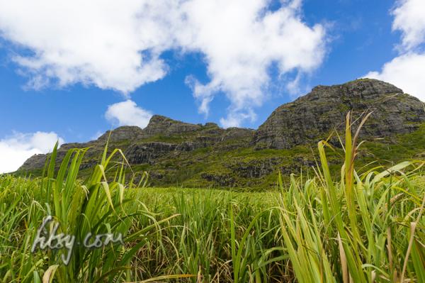
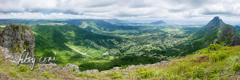
• Home
  • Mauritius Hiking routes
  • Contact
  • You are here:  
  • Home

Mount St. Pierre

 View from Mount St. Pierre

Mount St. Pierre is a small peak next to La Ferme reservoir and Corps de Garde mountain. It is not particularly high but is a short accessible hike offering nice views over the reservoir and Corps de Garde.

Location

The start of the path is located near the entrance to the Central Electricity Board solar energy farm in the village of Bambous on the west of the Island. Park your transport outside the gates or in a suitable location and follow the residential road along the fence and upwards into the mountain.

Read more: Mount St. Pierre

Pieter Both

The mountain of Pieter Both has an interesting shape, with a large boulder balanced on a slender peak. This mountain is one of the most discerning features of the Mauritian landscape.
The ascent of Pieter Both can be described as being in two stages, the first involves reaching the so called shoulder and for those willing to continue, the second part involves ascending the slender peak and onto the boulder at the top of the mountain. Iron rungs were placed in the rock many years ago, but the condition of these rungs have deteriorated, making the final ascent unsafe without the help of ropes and rock climbing experience.

Read more: Pieter Both

Montagne Blanche


Blanche mountain


Montagne Blanche located in the East is not a particularly high mountain, but is a fairly short hike and should be attempted should you have the opportunity. Be warned that the initial part of path up the mountain slope is in a muddy gully, so plan for this trip under dry weather conditions and expect to get dirty.


Read more: Montagne Blanche

Piton du Canot mountain

Piton du Canot is a small isolated peak lying on the south west of the island. Its location provides some great views over the south west coast and onto the valley of Chamarel, including the lagoon spanning from Black River to Le Morne and the island of Ile aux Benitiers.
The path is relatively short and the ascent can be accomplished within 45 minutes as there are no technically difficult parts along the path to the summit.

Location

The path to the summit of Piton du Canot mountain starts in the car park of Le Chamarel restaurant, adjacent to the Chamarel Forestry office.
There are buses from Quatre Bornes which go to Chamarel via Baie du Cap but due to the distance and route taken, the trip can take a considerable amount of time.

Read more: Piton du Canot mountain

Corps de Garde mountain

Corps de Garde mountain

Corps de Garde mountain is a can be a physically demanding climb, especially the first part up to the perched rock. But the views over the western coast all the way up to the north past Port Louis and the central plains of Mauritius, are very rewarding, and should hopefully serve as an incentive for you to try this route.
The path is also exposed to the sun, due to the lack of tall trees along the route, so you should ideally start this route as early as possible in the morning.

Location

Corps de Garde mountain is located on the western side of central Mauritius near the towns of Rose Hill and Quatre Bornes. The part of Rose Hill which lies neareast to Corps de Garde is known as Stanley.
There are no bus routes which pass near the start of the hiking route, located at the northern side of the mountain, so the only way to get to the starting position is by use of car or by walking from Stanley which you can reach by using buses which serve Stanley from Rose Hill bus station.
The start of the path is by a clearing adjacent to the road. There is a bridge over a small stream passing under the road. Park your car in this clearing.

Read more: Corps de Garde mountain

Piton Savanne

Piton Savanne mountain offers some good views of the south coast of Mauritius, and although the track can be overgrown in places, is a very accessible route with no major obstacles on the way.

Location

Piton Savanne mountain is located in the south of the Island of Mauritius and along with its neighbour Mount Cocotte are the only mountains offering views over the southern tip of the island.

The route starts at a location just off the main road from the round-about at Les Marres towards the southern town of Chemin Grenier. The area is visible from the main road, as there is a clearing next to a large grey gate.
There are no bus routes which serve this area, so a car is the only practical way of reaching this point.

Read more: Piton Savanne

Trois Mamelles, Centre Peak

Trois Mamelles mountain

Les Trois Mamelles mountain is located in the west of Mauritius and forms part of an isolated range compromising of Mt Rempart to the West and Les Trois Mamelles to the East.

There are three peaks to this mountain and this route describes the path for the centre peak.

Note that this track has been described as "This is true grade II climbing in the alps"

Location

The location of the mountain is easily accessible from the centre of the island and is near to the central urban area of Quatre Bornes. You can easily get to Quatre Bornes by bus and change to buses serving the West and South West and stopping near Bassin Estate.

A saloon car will get you near to the starting point, but you would be advised to leave it further away as there are few parking spaces in the sugar cane fields, and your transport could cause an obstruction to lorries working in these fields.

Read more: Trois Mamelles, Centre Peak

Page 1 of 4

  • Start
  • Prev
  • 1
  • 2
  • 3
  • 4
  • Next
  • End
fitsy.com
Back to Top