• Home
  • Mauritius Hiking routes
  • Contact
  • You are here:  
  • Home

Bambous mountain

Notes: -

  • This is quite a rough, wet and overgrown trail, so choose the members of your group carefully (no children!).
  • Allow 2 to 2.5 hours (or more) for the ascent and about the same for the descent, so start as early as possible.
  • The path appears and disappears, try and keep with the general guidance of this gps trail.
  • Go around large rocky outcrops rather than try and tackle them head on.
  • The final ascent can be tricky, and may put off some members of your group.
  • Some short-cuts were initially taken on this track across sugar cane fields and a stream to get to the starting point. Use whatever path you find suitable to get to the waypoint marked 'Starting Point'.

Read more: Bambous mountain

Tamarin Mountain

Tamarin Mountain

Location

Tamarin mountain is on the west coast, and is accessible by public transport. The start of the path is near a residential area, some distance away from public transport routes, so a private car is ideally required.

NOTE: You need to cross a (broken) fence to join the path behind the water storage tank. Crossing a fence might be construed as trespassing! Choose your day/time wisely and don't turn up by the bus load. Finding the route 'on the internet' is unlikely to be a valid excuse if challenged. Discretion is key!

Read more: Tamarin Mountain

Le Morne mountain


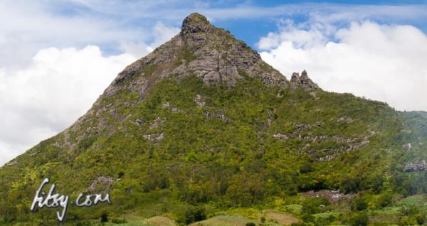
Le Morne mountain has a lot of history...

Finally, in mid 2016, the disputes ended which meant that the hiking track to the mountain was opened up to the public.

The hiking track is managed, with a parking area opposite the entrance, and there is a gate at the start of the track which is open from 07:00 to 16:00.

This hike is popular and it is likely that there will be quite a few hikers undertaking this route. The path is mostly well signposted and clear, so using the GPS track isn't required to find your way to the summit.

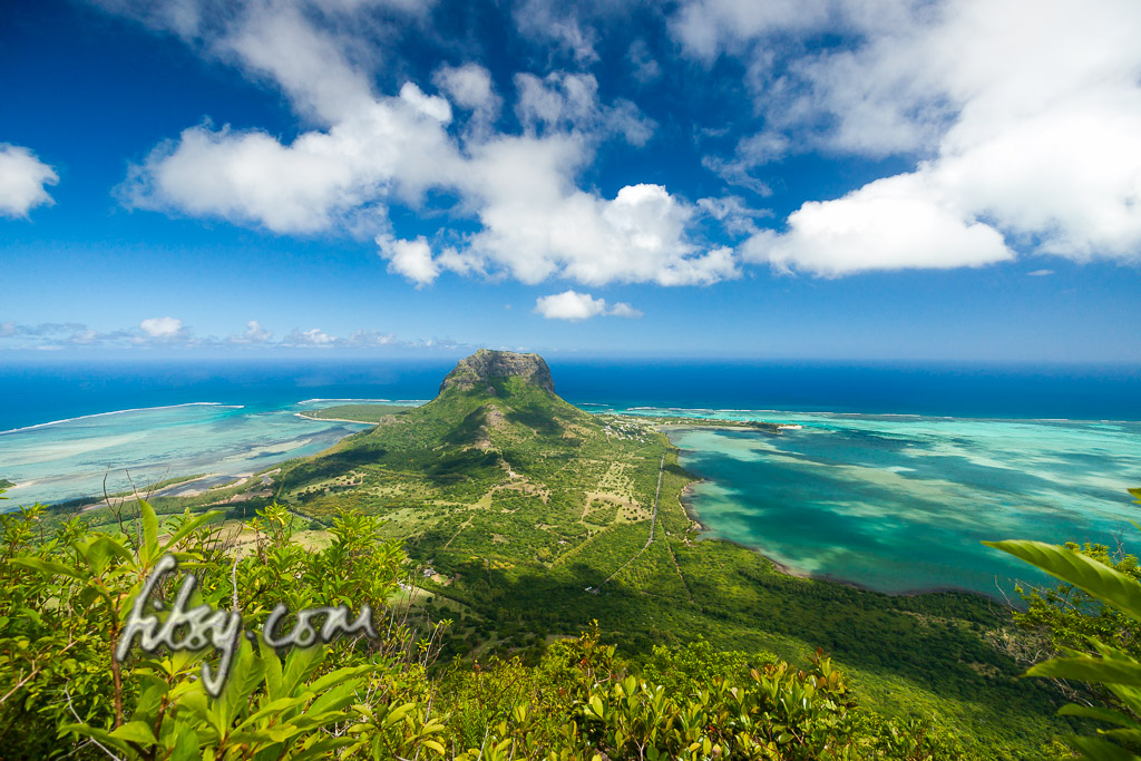
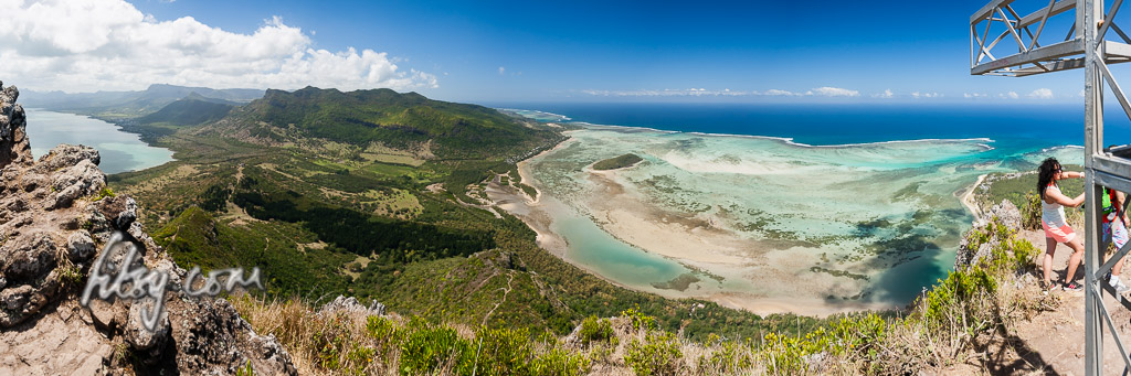
 There are two parts to the hike, the first part starts from the entrance and follows a well maintained forestry track to reach a plateau with a viewpoint, and from here, the typical mountain climbing path starts to the small summit where the steel cross is located. Strictly speaking, this isn't the uppermost summit of the mountain, as to reach the summit, mountain climbing equipment will be needed to cross a cleft. Nonetheless, this is an interesting hike which should be on your list of 'to-do' mountains.

As of September 2016, the part of the trail from the plateau to the cross is officially closed due to the ropes placed on the rocky ascent being 'under maintenance', but this should not be an impediment to reaching the summit by the cross, as the ropes are not necessary for either the ascent or the descent, and you will find plenty of people ignoring the warnings to continue to the summit. There is also conflicting information about whether hikers are allowed to continue to the cross without the use of guides. It would be wise to inform yourself beforehand in case you are challenged "aggressively".

Note, the mountain trail from the viewpoint to the cross has been helpfully described as: "In the Alps this could be rated as climbing grade between I and II on the international UIAA rock climbing scale."


Read more: Le Morne mountain

Montagne Cocotte

Mount Cocotte is located on the southern highlands of Mauritius, and along with it's neighbour Piton Savanne, are the only two mountains offering views over the south of the Island.

The hike is relatively easy, but is overgrown, wet and muddy in places.

Read more: Montagne Cocotte

Calebasses Mountain


This is a very short hike which ideally should be combined with another hike in the area such as Montagne Deux Mamelles a few kilometres away to the West.

Location:

Make your way to Nouvelle Decouverte which is the village nearest to the starting point. There are bus routes travelling in this area so public transport is an option. If you are using your own private car, you might have trouble finding parking near the starting point, and you may have to leave it a little further off the narrow main road. The small roads leading to the track are used for agricultural lorries and trucks, and you will not be able to find a parking spot in this area without causing an obstruction.

Read more: Calebasses Mountain

Guiby peak


Location

Guiby peak is at the eastern end of the Moka mountain range, near the villages of Petit Verger near Saint Pierre, Moka. The path starts at the same location as the path for Le Pouce mountain.

Read more: Guiby peak

Signal Mountain and Quoin Bluff

View from Quoin Bluff mountain, Mauritius


Signal Mountain and Quoin Bluff are two neighbouring mountains in the North East of Mauritius overlooking Port Louis and the valley of Pailles.

Since the road to Signal mountain is tarred and without hurdles, this hike is suitable for all ages and abilities. Similarly, the short hike from Signal Mountain to Quoin Bluff is also without any technical obstacles.


Read more: Signal Mountain and Quoin Bluff

Page 2 of 4

  • Start
  • Prev
  • 1
  • 2
  • 3
  • 4
  • Next
  • End
fitsy.com
Back to Top