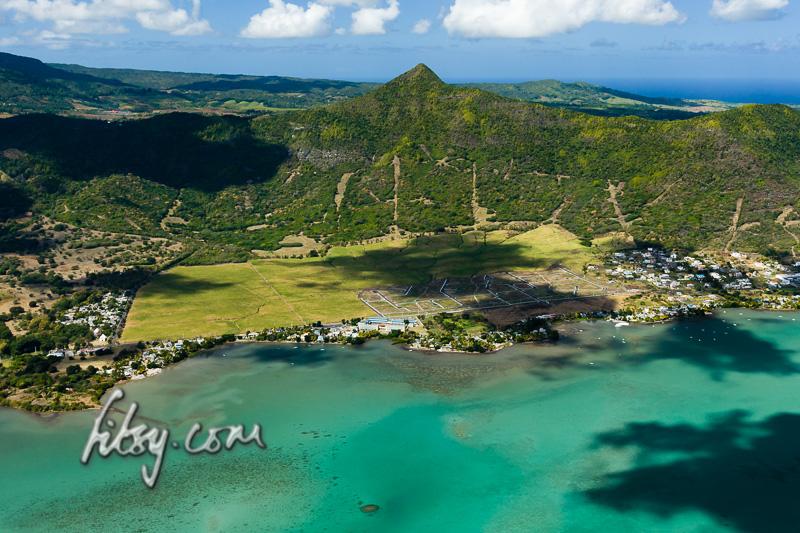
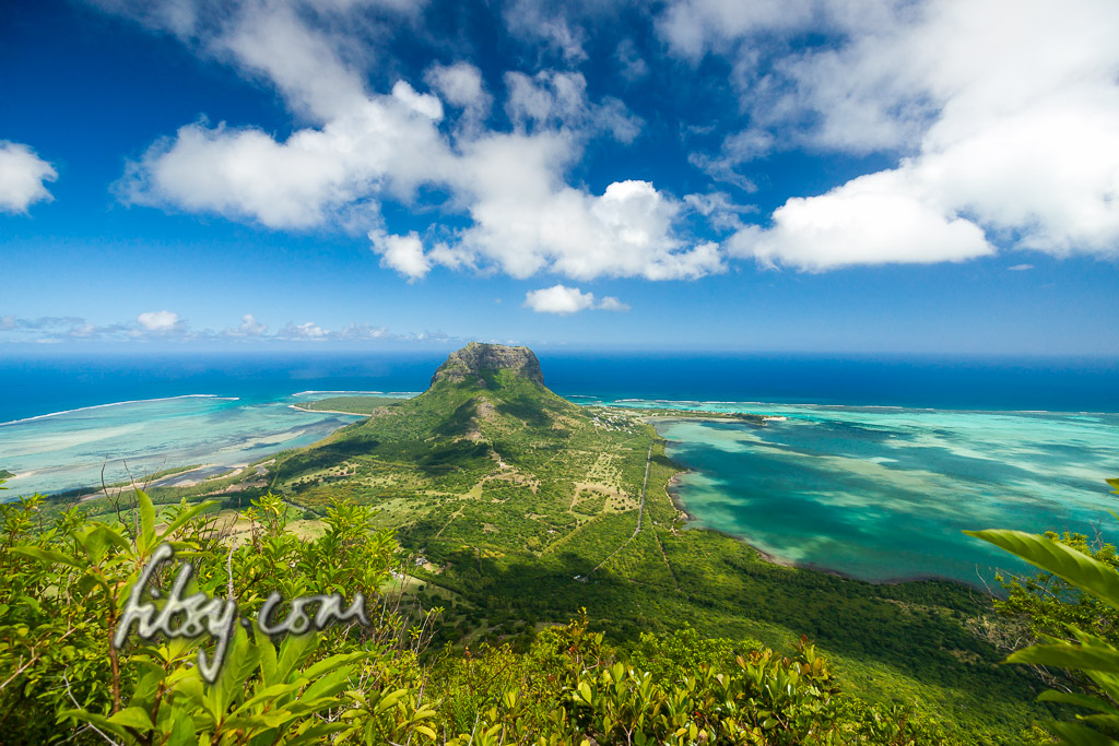
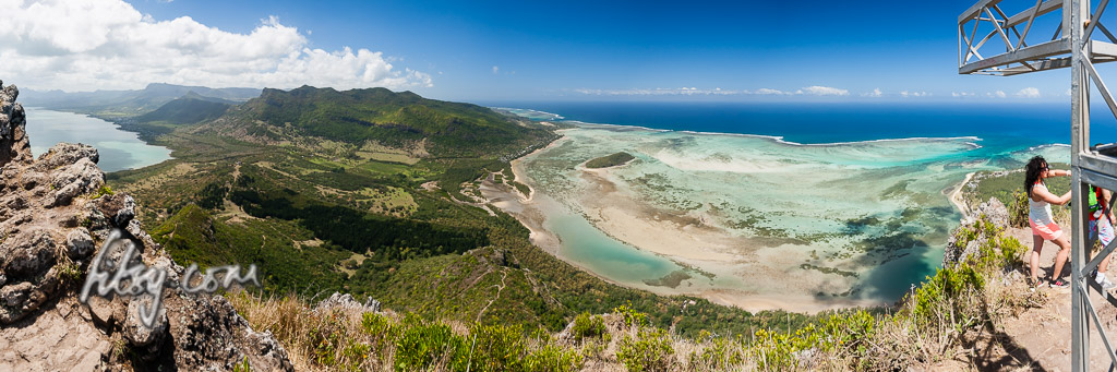
Piton du Canot is a small isolated peak lying on the south west of the island. Its location provides some great views over the south west coast and onto the valley of Chamarel, including the lagoon spanning from Black River to Le Morne and the island of Ile aux Benitiers. The path is relatively short and the ascent can be accomplished within 45 minutes as there are no technically difficult parts along the path to the summit.
Location
The path to the summit of Piton du Canot mountain starts in the car park of Le Chamarel restaurant, adjacent to the Chamarel Forestry office. There are buses from Quatre Bornes which go to Chamarel via Baie du Cap but due to the distance and route taken, the trip can take a considerable amount of time.
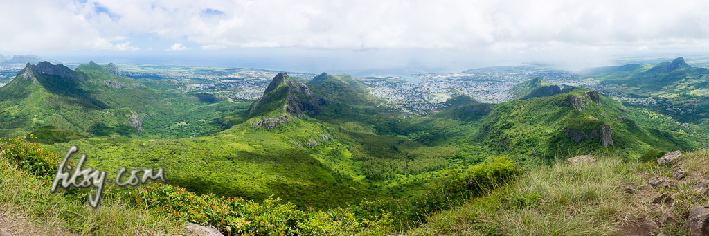
Le Pouce mountain, located in Moka, offers some very good views over the North West of the island towards the capital Port Louis, and on a clear day, the coastline of the North and East of the island can be seen. It is an easily accessible climb in the centre of the island, and relatively easy in ascent.
Location
The starting point of the route is in Petit Verger near the village of Saint Pierre. The location is served by buses and is easily accessible using buses going to and from Port Louis, or from other locations by changing buses at Saint Pierre. There is an alternate route starting from Port Louis, but the difference in altitude from that starting point is greater, making it more physically demanding and a longer climb.
If you are using a car, park the vehicle on the tarred road just before the bridge at the junction a few metres away from the main road, or continue to the end of the road where there are a few more spaces to leave your car.
The hike to the summit of Le Pouce mountain is relatively popular and attracts a lot of people, especially at weekends and public holidays. There have been reports in the past of petty theft from vehicles parked in the area. Do not leave valuables in view inside your vehicle.
This is quite a rough, wet and overgrown trail, so choose the members of your group carefully (no children!).
Allow 2 to 2.5 hours (or more) for the ascent and about the same for the descent, so start as early as possible.
The path appears and disappears, try and keep with the general guidance of this gps trail.
Go around large rocky outcrops rather than try and tackle them head on.
The final ascent can be tricky, and may put off some members of your group.
Some short-cuts were initially taken on this track across sugar cane fields and a stream to get to the starting point. Use whatever path you find suitable to get to the waypoint marked 'Starting Point'.
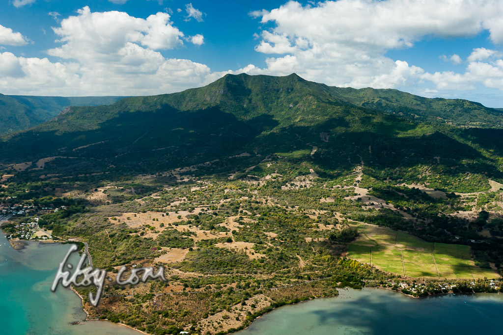
The mountain is located in the south west of Mauritius in the Black River National Park. The path starts near the Black River gorges viewpoint, and the parking area is where you should leave your transport.
There are no public bus routes travelling through this area and you will need to travel by your own car or taxi, to the car park of the Black River Viewpoint.
Depending on your starting point, the area is accessible westwards from the coastal road at La Gaulette through the mountains of Chamarel, or from the south by either the road at the village of Baie du Cap or the road from Souillac. There is also the road from the East passing through Plaine Champagne and Les Marres.
"The appearance of some [mountains] have, indeed, conjured up in the minds of some viewers a strange assortment of embroidered phrases and phantasies about their supposed origins and their imaginary sculptors. There are many, of course, which challenge man to climb and tempt him to rest awhile on their wind-swept summits."
L. F. Edgerley. Preface to "Mountains of Mauritius A Climber's Guide. Robert V.R.Marsh" c. 1975
So, if you're heading to Mauritius or have been there previously, those little peaks dotted around the island have probably caught your attention.
But knowing where to start, or even trying to find information can be a frustrating experience, but thanks to the modern day GPS - this is now a lot easier.
Finally, in mid 2016, the disputes ended which meant that the hiking track to the mountain was opened up to the public.
The hiking track is managed, with a parking area opposite the entrance, and there is a gate at the start of the track which is open from 07:00 to 16:00.
This hike is popular and it is likely that there will be quite a few hikers undertaking this route. The path is mostly well signposted and clear, so using the GPS track isn't required to find your way to the summit.
There are two parts to the hike, the first part starts from the entrance and follows a well maintained forestry track to reach a plateau with a viewpoint, and from here, the typical mountain climbing path starts to the small summit where the steel cross is located. Strictly speaking, this isn't the uppermost summit of the mountain, as to reach the summit, mountain climbing equipment will be needed to cross a cleft. Nonetheless, this is an interesting hike which should be on your list of 'to-do' mountains.
As of September 2016, the part of the trail from the plateau to the cross is officially closed due to the ropes placed on the rocky ascent being 'under maintenance', but this should not be an impediment to reaching the summit by the cross, as the ropes are not necessary for either the ascent or the descent, and you will find plenty of people ignoring the warnings to continue to the summit. There is also conflicting information about whether hikers are allowed to continue to the cross without the use of guides. It would be wise to inform yourself beforehand in case you are challenged "aggressively".
Note, the mountain trail from the viewpoint to the cross has been helpfully described as: "In the Alps this could be rated as climbing grade between I and II on the international UIAA rock climbing scale."
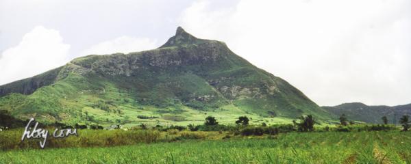
Montagne Blanche located in the East is not a particularly high mountain, but is a fairly short hike and should be attempted should you have the opportunity. Be warned that the initial part of path up the mountain slope is in a muddy gully, so plan for this trip under dry weather conditions and expect to get dirty.